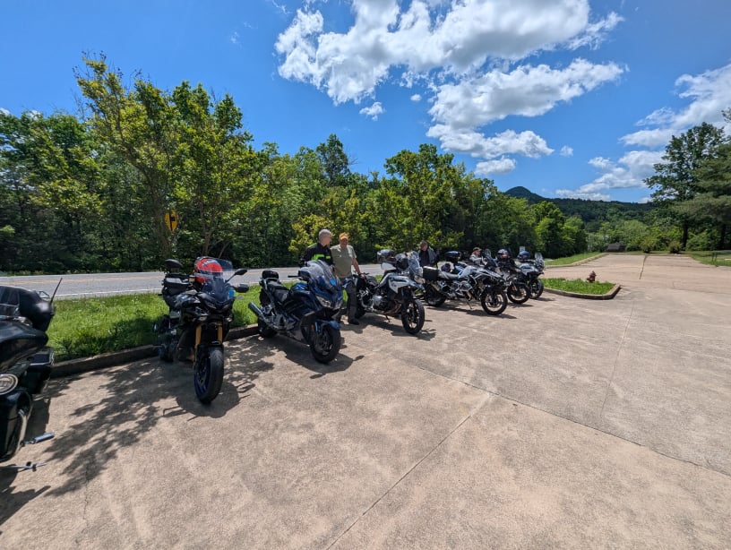
All Road Routes Collection

10+ Road Routes to choose from
Note: These routes are available for STAR attendees only-
please do not share them with others.

Note: To download GPX & ZIP files, right-click or control-click the links. Otherwise you may get a 404 error. 

(Do not use Zip versions if there are last minute route changes- individual routes will be most up-to-date)
Note: To download ZIP files, right-click or control-click the links. Otherwise you may get a 404 error. 

All Road Routes GPX format

All Road Routes:

MAP GPX 
RouteType: TWISTY, TECHNICAL, DESTINATION
Navigation difficulty: AVERAGE
Distance: 184 - 285 miles
Lunch Stop: Tellico Plains Bakery Restaurant, Tellico Plains, TN, other choices nearby.
Direction from STAR HQ: S, CLOCKWISE
Comments: Get out of Knoxville fast on I-140, aka Pellissippi Parkway. Ride it all the way to the end at Maryville Pike (SR33). Follow the route past Sam Houston School House. Stop if you have the time and interest. Continue the route along the Little River to Walland, cross over to US321, and take the Foothills Parkway southwest until it intersects with US129. Turn left. In just a few miles you are now on the “Dragon” or “Tail of the Dragon” and headed toward Deals Gap. This may be the most famous road in the USA. Stay in your lane and out of the way of faster bikes. Too many people treat this stretch of road like a racetrack, and many pay an extreme penalty. Don’t be one of them and don’t let one of them take you out.

Upon reaching North Carolina and the Deals Gap Motorcycle Resort, stop and stretch your legs. They serve food in the restaurant and have gasoline if you need it. You have a choice to make. There are four alternative routes taking you to Santeetlah Gap and the start of the Cherohala Skyway:

Option 1: The shortest way is to continue on US129 crossing the river at the bottom of Cheoah Dam. This dam was featured in the 1993 movie The Fugitive. Continue until you turn off onto Joyce Kilmer Rd and follow it (don’t miss the right turn across the bridge) along Lake Santeetlah to Horse Cove and Joyce Kilmer Slickrock Wilderness (very sketchy pavement). Turn left and Santeetlah Gap is just a short distance.
Option 2: A slightly longer way follows the same road as above route; it just doesn’t make the turn across the bridge and takes you to Santeetlah Dam. Continue the route back to US129 and then follow it until you intersect SR143. This will take you to Santeetlah Gap.
Option 3: A longer version takes SR28 away from Deals Gap. It offers the opportunity to visit Fontana Dam. Once past Fontana Dam you will turn onto SR143, go across Stecoah Gap and on to Robbinsville. If you’ve waited for lunch, Lynn’s Place is the place to refuel your body. Continue on SR143 to Santeetlah Gap.
Option 4: Finally, the longest version takes SR28 all the way to Franklin. There are numerous restaurants there and a few are listed in the route. It would be wise to purchase fuel there if you haven’t already. The return from Franklin takes you across Wayah Gap Road. These are the most curves you’ll ride on this entire long day. Wayah Gap Road ends at the put-in for Nantahala rafters. Turn left on US19/74 and ride up and out of the Nantahala Gorge to turn right on US129 which will take you to Robbinsville and Santeetlah Gap.

Now you begin the Cherohala Skyway. It climbs up to over 5000 feet in elevation and has tremendous views. Temperatures will drop. The curves are gentle and you can generate some speed. Think twice about that. Park Rangers patrol this road and federal citations are costly. Also, there is no fuel on the Cherohala until you get to Tellico Plains.


Optional Detour: For those that cannot get enough, there is a detour to Bald River Falls. There is a narrow short cut over to River Road. After viewing Bald River Falls, return to the Skyway and continue into Tellico Plains.

There are numerous restaurants in Tellico Plains. For cheap fare try Tellico Beach. Tellico Bakery is terrific for sandwiches and baked goods. The Exxon station is the center of the universe for motorcyclists going both ways on the Cherohala. Avail yourself if fuel is needed.

The trip back to Knoxville is a series of nice quiet backroads, part of which run along the east coast of the Tellico Reservoir. The shortest version of this route will only take about 5 to 6 hours and is 184 miles. The longer version to Franklin is 285 miles and will take all day. 

MAP GPX 
RouteType: TWISTY, TECHNICAL, DESTINATION, OPTIONAL SHORT GRAVEL
Navigation difficulty: AVERAGE to COMPLEX
Distance: 233 miles
Lunch Stop: RM Brooks General Store & Restaurant, Rugby, TN (Closed Sunday & Wednesday)
Direction from STAR HQ: NW, CLOCKWISE
Comments: This loop takes in the Devils Triangle, much of the eastern Cumberland Plateau, and the Norris Dam. It begins by avoiding Oak Ridge except for the waterfront. This is a world class rowing facility. Afterwards you will be taking the road through Frost Bottom with the mountains towering over you. At the intersection with SR116 you turn left and start your climb over Graves Gap and descend the other side. At the New River the road makes an abrupt change of direction and continues through closed mining facilities and then up and over the mountain.
At the base of the mountain lies Brushy Mountain Prison. It’s closed now, although tours are available. There’s even a restaurant (check the hours before you go). This maximum security prison housed many felons over its 100+ year history, including James Earl Ray.

After the prison this route takes you on backroads to a local swimming hole at the base of Potters Falls. Leaving there takes you into downtown Wartburg and past the Morgan County Jail and Morgan County Courthouse. Take old 27 out of town and then Montgomery Road across the Emory River eventually reuniting with SR62. After Lancing you’ll turn north on Rome Road and go through Deer Lodge. Continue with the route until you cross SR52. RM Brooks General Store will be right in front of you on the old road through Rugby. The store is now a restaurant, CLOSED ON SUNDAY & WEDNESDAY, and on the National Register of Historic Places. Great baloney sandwich and other good eats, cheap.

Leaving RM Brooks on the loop takes you through Rugby. Rugby was founded in 1880 as an experiment for the “second sons” of English noblemen, offering them a chance to own land. The Victorian architecture and picturesque setting have since made it a popular tourist attraction. The town is also on the National Register of Historic Places. Stop at the visitors’ center and learn a bit about it. https://en.wikipedia.org/wiki/Rugby,_Tennessee

Leaving Rugby, you are presented with a choice. You can go west on SR52 to follow the Honey Creek alternative route. It has 6.5 miles of smooth, hard-packed gravel and goes to a fabulous overlook of the Big South Fork of the Cumberland River Gorge. It loops back into the route at its intersection with US27.

The route turns east onto SR63 going through Huntsville, the home of the late statesman Howard H Baker. Continue until the route turns off onto old 63 and slow down. This fine but nearly abandoned road travels along Cove Creek to Caryville. You could get on the interstate here, but don’t. SR116 parallels the slab to Rocky Top (aka Lake City). Here, you will turn onto US441 and cross Norris Dam. Be sure and stop at the overlook before descending to the dam to see the Clinch River pouring out of Norris Dam. Norris Dam was the first one constructed by TVA in 1936.
Continue following the route as it brings you back to Knoxville on bucolic backroads. 

MAP GPX 
RouteType: TWISTY, TOURING BIKE FRIENDLY, DESTINATION
Navigation difficulty: AVERAGE
Distance: 298 miles
Lunch Stop: Whistle Stop Pizzeria & More, Baxter, TN, Rock Island Market, Rock Island, TN, Butter Dish Restaurant, Pikeville, TN
Direction from STAR HQ: W, COUNTERCLOCKWISE
Comments: This ride takes you through Oak Ridge and continues on SR62 across the Cumberland Plateau. There is a side trip at Wartburg to see Potters Falls, a local swimming hole and our first falls. After passing through Monterey, you will turn onto Woodcliff Road and descend down Brotherton Mountain to Algood. From there a series of backroads will deliver you to Cummins Falls State Park. You will have to park and walk approximately a quarter mile to the overlook to see the falls. The descent into the gorge is a 3 mile roundtrip hike and quite strenuous. It’s better to save oneself for the other walks to see more falls later in the day.

After leaving Cummins Falls the route takes you into Baxter for lunch at the Whistle Stop Café. If you aren’t ready to eat stay on SR56 until you cross under I-40. The route will take you to SR135 where you’ll soon reach Burgess Falls State Park. Again, park your bike and walk the trail to the falls. There are several falls to see along the trail culminating in the 130 foot tall Burgess Falls.

After leaving Burgess Falls you will travel south for about 18 miles to Twin Falls in Rock Island State Park. Ride to the end of the road and park. You can see these falls from the parking lot or you can walk down into the river gorge. These falls are unusual in that the water comes from the Collins River adjacent to the escarpment and flows through rock to exit in numerous places and drop into the Caney Fork River’s gorge. These falls didn’t exist until the rivers were dammed by the Great Falls Dam. The Rock Island Market serves food and gasoline if you need either.

Next the route takes you down to SR30 which will take you to Spencer. Here you will turn south and head into Fall Creek Falls State Park. The scenic loop is one-way and includes a short walk to Fall Creek Falls, the highest one east of the Mississippi. There are other sights to see on the loop as well, but it may be getting late or you may be hungry. The park’s restaurant is newly remodeled and ready to serve you.

Complete the route through the park and rejoin SR30 to head home. The road will descend into the Sequatchie Valley, go through Pikeville (gas or food available), and then climb Waldens Ridge before descending into Dayton. Dayton was the site of the Scopes Trial in 1925 and you can visit the courthouse where it happened.

From Dayton the route takes you across Watts Bar Dam and then along River Road to Kingston where you pick up US70 and head back to Knoxville.  

MAP GPX 
RouteType: DESTINATION, TOURING BIKE FRIENDLY, EZ NAVIGATION, SHORT
Navigation difficulty: SIMPLE
Distance: 139 miles
Lunch Stop: None
Direction from STAR HQ: SE, COUNTERCLOCKWISE
Comments: Our shortest loop begins with getting out of town fast on I-140 aka Pellissippi Parkway. After crossing the Tennessee River, exit at Topside Road. Follow the route until you are on US129. Fuel is not available on the parkway so gas up at Fast Lap Market if necessary. This is not the section known as the “Dragon”, but it’s really scenic along the lake. Turn onto the Foothills Parkway and enjoy. It climbs up onto Chilhowee Mountain and runs for 18 miles to Walland. The parkway used to end here, but now continues 14 more miles to Wears Valley and the newer section is superb.

Be sure to stop at the overlooks to see a great view of Townsend and also look at the construction of the road. They basically built viaducts to avoid excavating so much out of the mountain. It’s truly an engineering feat.

Gasoline is available in Wears Valley. The drive through Wears Valley can be heavily trafficked by tourists in the summer months but relief is coming. Turn off at Russie Gap Rd and follow the route to US441/411 to avoid Pigeon Forge and Sevierville. The remainder of the ride back to west Knoxville is less rural but avoids the worst of the urban congestion.  

MAP GPX 
RouteType: DESTINATION, TOURING BIKE FRIENDLY
Navigation difficulty: SIMPLE
Distance: 368 miles
Lunch Stop: Lots of dining choices at Lynchburg, TN, town square
Direction from STAR HQ: SW, CLOCKWISE
Comments: This ride is more about the destination than the ride. It follows more highways and fewer bucolic backroads. If you plan to tour Jack Daniels use this link for information: https://www.jackdaniels.com/en-us/visit-distillery

You will leave Knoxville and travel along Ft Loudon Lake to Lenoir City, cross the Tennessee River into Loudon and then traverse the valley until you reconnect with the river along Watts Bar Lake. After crossing the river at Watts Bar Dam you will continue to Dayton and soon start climbing up onto the plateau. Running southwest along Waldens Ridge you will connect with SR111. It descends into the Sequatchie Valley with spectacular views on the way down. The route goes through Dunlap and then climbs out of the valley and onto the southern Cumberland Plateau. You will go through the village of Gruetli-Laager and then descend off the plateau to Pelham. From there it’s primarily farm country the rest of the way to Lynchburg.

In Lynchburg you can tour the distillery and shop or eat on the square. There are outlet stores there including one for Diamond Gusset jeans. Numerous restaurants are available.

Returning will be less interesting. The route runs primarily on state highways. SR30 is somewhat engaging as it leaves Spencer and descends into and out of a gulf prior to reaching an entry to Fall Creek Falls. The next many miles are spent crossing the Cumberland Plateau until US70 dumps you into Rockwood. From there it’s straight shot back to Knoxville.

This is a very long day at nearly 400 miles. Gas stations are plentiful with a few marked along the route. 

MAP GPX 
RouteType: TWISTY, only sketchy pavement is on old Route 63. Has some tight switchbacks.
Navigation difficulty: Average
Distance: 237 miles
Lunch Stop: West Fork General Store, Alpine, TN
Direction from STAR HQ: NW, CLOCKWISE
Comments: This loop takes in many sights and great roads on the northern Cumberland Plateau and Highland Rim. You will travel through Oak Ridge and follow SR62 toward Wartburg. Turn off SR62 at Coalfield and follow the route to Potters Falls, a local swimming hole. Afterwards, the road takes you into downtown Wartburg and past the Morgan County Jail and Morgan County Courthouse. Take old 27 out of town and then Montgomery Road across the Emory River eventually reuniting with SR62. In approximately 20 miles you will intersect US127 in Clark Range. Go north and turn left onto SR85. It begins to drop and crosses the East Fork of the Obey River almost immediately. It climbs back up and runs several miles before it drops off the Highland Rim in nine (9) switchbacks and runs nine miles to Alpine. The West Fork General Store is at the intersection with SR52. They have great sandwiches and hamburgers as well as fuel.

Travel east on SR52 to Jamestown. Use SR154 to avoid Jamestown proper and follow it to the intersection with SR297 turning east toward the Big South Fork. The road will descend into the gorge and cross the river (on a bridge) at Leatherwood Ford and then climb out of the gorge continuing to Oneida. SR456 will continue east and south taking you to SR63. Travel east nine miles turning off on old 63 and slow down. This fine but nearly abandoned road travels along the creek to Caryville. You could get on the interstate here, but don’t. SR116 parallels the slab to Rocky Top (aka Lake City). Prior to reaching Rocky Top the route turns left on Cherry Bottom Rd and climbs a bit running near Norris Lake. After reaching US441 travel toward Norris Dam but stop at the overlook before you get there. It’s a terrific view of the dam, the lake, and Clinch River as it runs out of the dam.

Continue on US441 until you get to the intersection with SR61 in Norris. Follow SR 61 past Andersonville where it will begin to twist and turn as it traverses the numerous ridges and goes past Big Ridge State Park. Eventually in a switchback you will turn off on Loyston Rd. A series of backroads will bring you back to Knoxville. 

MAP GPX 
RouteType: SOME TWISTIES, SMOOTH PAVEMENT, TOURING BIKE FRIENDLY
Navigation difficulty: AVERAGE
Distance: 222 miles
Lunch Stop: Rod's Rockin Rolls, Ducktown, TN
Direction from STAR HQ: S, COUNTERCLOCKWISE
Comments: This route utilizes some of our great backroads from the beginning. You will leave Knoxville and proceed through Loudon and Madisonville on backroads all the way to Englewood. From there SR39 takes you to SR310 which runs to Reliance. Cross the Hiwassee River and be sure to stop at the old general store at the end of the bridge. Continue on SR30 twisting and turning until it gets to US64. Go west and turn onto Oswalt Road which climbs up to several overlooks of Parksville Lake and Georgia off in the distance.

Retrace your steps down Oswalt Road and US64 but continue to Ducktown in the Copper Basin. Although recovery is ongoing, copper mining and smelting destroyed all the vegetation in this area in the first half of the 20th century. There are numerous restaurant choices in the area but Rod’s Rockin’ Rolls comes highly recommended. Plenty of fuel is available here as well.

After refueling head north on SR68 to Tellico Plains. SR360 will take you from there to Vonore where you’ll have to go north on US411 to cross the river. Take the East Tellico Parkway and Unitia Road to take you to Friendsville and then SR333 to Louisville where you will pick up I-140 (Pellissippi Parkway) to return to the Holiday Inn. 

MAP GPX 
RouteType: TWISTY, TECHNICAL
Navigation difficulty: COMPLEX
Distance: 241
Lunch Stop: Wooden's Apple House, Pikeville, TN
Direction from STAR HQ: SW, CLOCKWISE
Comments: This route contains many steep, narrow roads with sketchy pavement and switchbacks. Ride accordingly.

Get out of town and past Loudon. SR72 crosses numerous ridges and valleys as it winds westward. River Road SR304 takes you south along Watts Bar Lake and you will cross the dam past Watts Bar Nuclear Plant. The route follows the old Dixie Highway for a while before coming to SR30. White Flats Rd takes you to Evensville and then you start the climb. Soon you’re on top of Walden Ridge and will travel on top for some distance. You will pass Wooden’s Apple House. It’s a great place for meat and three or to pick up some apple pie: fried or baked. Continue on the route and Pitt Mountain Rd will take you down into the Sequatchie Valley.

The route crosses the Sequatchie River and US127 and then climbs out of the valley. If you’re interested in Mennonite Goods continue past the route’s right turn to Oak Ridge Pantry on Brockdell Rd. Return to the route and it will descend back into the valley on Lee Station Mountain Rd. You’ll go north into Pikeville where food and fuel are available. You are in the Central Time Zone here.

There’s another twisty climb out of Pikeville and some more riding on top before we descend into the valley yet again on Big Springs Rd. Cross US127 again and now we’ll take the old Highway 28 all the way to Crossville. Look for the origin of the Sequatchie River and the Justin P Wilson Trail HQ as you ascend out of the valley.
As you approach Crossville you can depart the route and eat at Cumberland Mountain State Park or visit the Homestead Museum. The route takes you past many homes built with Crab Orchard stone during the homesteading. Eventually you reach US70 and start east toward Knoxville. Stop at Ozone Falls and walk out to the falls (very short walk). Watch your step here.

Turn on SR299 and go toward Oakdale. There you will get on SR328 and descend to US27. Go south on US27 and onto SR61 toward Oliver Springs. Turn right on Blair Rd SR327 which will take you past the K25 site, one of the DOE sites that has been demolished. There is a museum there about the history of the site and its role in the Manhattan Project.

From here you simply go south on SR95 and east on I-40 to take you back to Knoxville. 

MAP GPX 
RouteType: TWISTY, TECHNICAL
Navigation difficulty: AVERAGE
Distance: 217-248
Lunch Stop: Michael's Familt Diner, Sneedville, TN
Direction from STAR HQ: NE, COUNTERCLOCKWISE
Comments: The Sneedville ride shows off some of East Tennessee’s most rugged country. This delightful ride starts by getting through town as quickly as possible on I-40. Take exit 398 and turn left on Strawberry Plains Pike. Continue on US25W/70 until the turnoff at Piedmont. Now we start onto the backroads that will avoid Morristown and take you across the Holston River near Rogersville. Choptack Road takes us over to SR66 which makes its first climb across the many ridges in this area. The switchbacks will keep you busy until you get to SR94 in the valley. Take it toward the Pressmens’ Home ghost town: https://en.wikipedia.org/wiki/Pressmen%27s_Home,_Tennessee

After passing this huge, eerie and overgrown facility you will come to SR70. Turn north and get ready to rail. Follow SR70 as it crosses ridges and the Clinch River into Virginia. As you descend one ridge the road will go around a huge mansion. Slow down because you have to turn onto Lower Wallens Creek Road. This delightful little road winds along parallel with the Powell River for many miles until it joins Mulberry Gap Road right at the state line with Tennessee. Follow SR63 through Mulberry Gap and over Powell Mountain to Sneedville. The place to eat is Michaels Diner. Order the chicken. Trust us on this. Also, better gas up while in Sneedville.

Option 1: Leave Michaels Diner on Back Valley Road until it joins SR33. After a short distance along SR33, turn and go through the gap to Caney Valley Road. You will occasionally see the Clinch River on your left as you ride toward US25E. Turn left and go a short distance to Bullen Valley Rd. The route will take you over to SR131 where you will turn onto Joppa Mountain Rd and go over Clinch Mountain (again) and drop to US11W. Go left and turn onto Owl Gap Rd and follow the route back to Knoxville on a network of backroads near the Holston River.

Option 2: Return to SR63 across Powell Mountain and follow it all the way to Harrogate where the route will take you into the historic town of Cumberland Gap. This is where the states of Tennessee, Virginia, and Tennessee converge. Ride through the Cumberland Gap Tunnel and return, then south to SR63 and some local roads will take you to Helms Ferry. Prior to accessing the ferry, call the Union County dispatch to ensure that the ferry is operating: (865) 992-5286. It’s a long ride out of there if the ferry isn’t running (and sometimes it’s not). Once across the ferry the backroads of the area between the two rivers will take you out to SR33. There you will head south and use a variety of backroads to return to Knoxville.
What about the Melungeons? https://en.wikipedia.org/wiki/Melungeon You are amongst them today in Hancock County.  

MAP GPX 
RouteType: TWISTY, TOURING BIKE FRIENDLY (Note- Ride to the top of Viking mountain is sketchy pavement giving way to loose gravel near the top.)
Navigation difficulty: SIMPLE
Distance: 286 miles
Lunch Stop: Engle's Roadside restaurant, Erwin, TN
Direction from STAR HQ: NE, COUNTERCLOCKWISE
Comments: Get out of town quickly on I-40. Exit 394 is Asheville Highway and takes you to a right on Governor John Sevier Highway. Fortunately, you’ll turn onto Thorngrove Pike and put the city and industrial area behind you. Follow the route along the French Broad River and its embayment, Douglas Lake all the way to Dandridge. There you will cross the river on the new bridge and continue to Newport. This is one of those cities that industrial closures has left hanging. Get on through here and now you’re out in the open, still next to the French Broad River. SR107 will take you away from the river and into the national forest.

Once you are on SR70 (not US70), it’s a short ride to the Viking Mountain turn-off. The road starts out paved but gets sketchy as it climbs. It’s smooth, but it is gravel in some places. Once at the top the views are spectacular in many directions. Return to SR70 via the same road. Pay attention and don’t be too distracted by the view as you descend.
Turn left on SR70 which becomes NC SR208 when you cross into North Carolina. Continue until you intersect with SR212 and take it to the north. It’s a twisty roller coaster until you arrive in Flag Pond. Continue to Erwin where you find fuel for you and your bike.

Leaving Erwin takes you north to Chuckey, where Davy Crockett was born. The route continues to Baileyton where there are more restaurants and fuel if needed. The ride from there continues through the rugged terrain of upper East Tennessee and eventually delivers you to US11E at Russellville. Go a short distance past the Mahle factory and turn and follow the route’s shortcut over to US25E.

Go north on US25E and cross the Cherokee Lake and turn left on Lakeshore Drive SR375. This magnificent road rises and falls and turns along the shore of Cherokee Lake all the way to SR92. If you like, turn left and visit Cherokee Dam. Return to the route and take Owl Hole Gap Rd, Indian Ridge Rd, and Richland Rd back to Blaine and US11W. This will take you to I-40 and back to the Holiday Inn. 

MAP GPX 
RouteType: TECHNICAL
Navigation difficulty: COMPLEX
Distance: 223 miles
Lunch Stop: Trish's Mountain Diner
Direction from STAR HQ: SE, CLOCKWISE
Comments: This route covers numerous backroads in Blount and Sevier counties. Local riders refer to this type of route as a “driveway tour.” Many roads are only one lane wide and wander the counties just a few miles from the busiest and most tourist infested places in the whole state. You’ll encounter few cars, see a covered bridge, and top some of the highest elevations in the valley. Don’t be fooled by the relatively short mileage. This ride takes all day.

MAP GPX 
RouteType: DESTINATION, TOURING BIKE FRIENDLY
Navigation difficulty: AVERAGE
Distance: 146-168 miles
Lunch Stop: Roane County Park which is less than 35 miles from the STAR HQ hotel. Catered lunch from Buddy's BBQ requires a Lunch Ticket that can be purchased at event registration.
Direction from STAR HQ: W, SW, COUNTERCLOCKWISE
Comments: 
Direct Route: The most direct route (34 mi) will get you away from the hotel on surface streets intersecting with US70 just before you leave Knox County. It’s a direct ride from there to Roane County Park just west of Midtown. The ride from US321 to Kingston is fun curves and sweepers.

Indirect Route: This route is 20 miles further and wanders through Knox, Loudon, and Roane counties on little backroads. The last part of the ride travels along the Tennessee River (Watts Bar embayment) finally delivering you to Roane County Park.

Long Ride Home: Utilizing backroads to avoid Rockwood takes you back to US70 and then up onto the plateau. US70 twists and turns to the community of Ozone where one can park and take a short walk to the top or bottom of the falls. Return east on US70 to Dogwood Rd and ride south. Eventually the route will take you to SR68 at Grandview. The route will take you down the mountain and into Spring City. Fuel is available here and then you will continue on New Lake Rd (SR302) back to SR68 which will take you across Watts Bar Dam. From here a series of backroads will wander across Meigs and Loudon counties to Loudon. US11 takes you to yet more backroads to avoid Lenoir City and then into Knox County for the return to STAR HQ (total: 112 mi). 

AI Website Generator